EXPLORATION
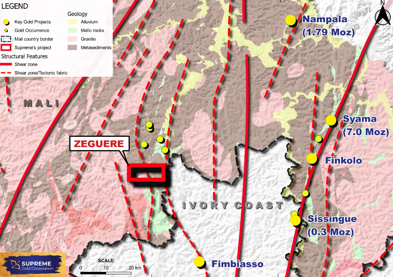
Zeguere concession is located in southern Mali, West Africa, 300 km south east of the capital of Bamako and covers 80 km2 area. The permit is located on a greenstone belt which runs between the Syama belt in the east and the Morila belt in the west. A significant number of gold deposits, mines and prospecting permits, including the Syama gold mine, Tabakorani gold mine, Morila gold mine, Sissingue mine, Finkolo deposit and Nampala deposit, surround the concession.
Zeguere
 OWNERSHIP
SUPREME GOLD CORPORATION
METAL
GOLD
LOCATION
MALI, WEST AFRICA
Zeguere concession is located in southern Mali, West Africa, 300 km south east of the capital of Bamako and covers 80 km2 area. The permit is located on a greenstone belt which runs between the Syama belt in the east and the Morila belt in the west. A significant number of gold deposits, mines and prospecting permits, including the Syama gold mine, Tabakorani gold mine, Morila gold mine, Sissingue mine, Finkolo deposit and Nampala deposit, surround the concession.
EXPLORATION
The Zeguere Project is located within the Birimian Supergroup of the West African craton, which includes linear and arcuate volcano-sedimentary belts, granitoid-dominated terranes and younger sedimentary basins. The Birimian constitutes the largest Paleoproterozoic gold-producing region for orogenic style gold deposits within the world, extending over Guinea, Senegal, Mali, Burkina Faso, Ivory Coast and Ghana.
There are a few Artisanal and Small-scale Gold Mines (ASGM) outside the concession on its north. These include the ASGM sites at Fatou, Finninko and Futierre. Structural studies using remote sensing data indicates the continuity of these structures into the concession.
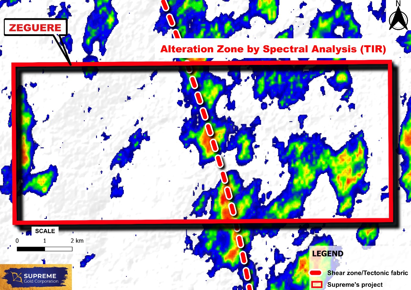
Supreme initiated its exploration program in the Zeguere concession in February 2022 with the digital analysis of multispectral satellite remote sensing data for alteration mapping by Dirt Exploration, South Africa. The spectral analysis has helped in delineating a few potential alteration zones based on coincident alteration styles and structures.
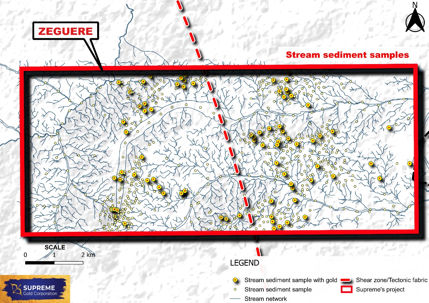
This was followed by a stream sediment sampling program covering the entire concession. All stream sediment samples were panned and the gold grains recovered were recorded. Field verifications were carried out in the provenance areas of anomalous gold occurrences to rule out the presence of transported laterite in those domains.
A major soil /termite mound-sampling program was executed covering the entire concession of 80 sq km on a 200 m x 200 m grid. All samples were analyzed at Bureau Veritas by FAA for Au. The geochemical contours show at least five major anomalous zones mostly located in the central part of the concession coinciding with a zone of intrusive bodies and a shear zone.

Ground magnetic survey has been carried out in the Zeguere concession on 100m line spacing using the modern Overhauser magnetometers with inbuilt GPS, covering a total of 804 line km. Modelling and interpretation of the magnetic data has led to the identification of structures which also coincide with the geochemical anomalies.
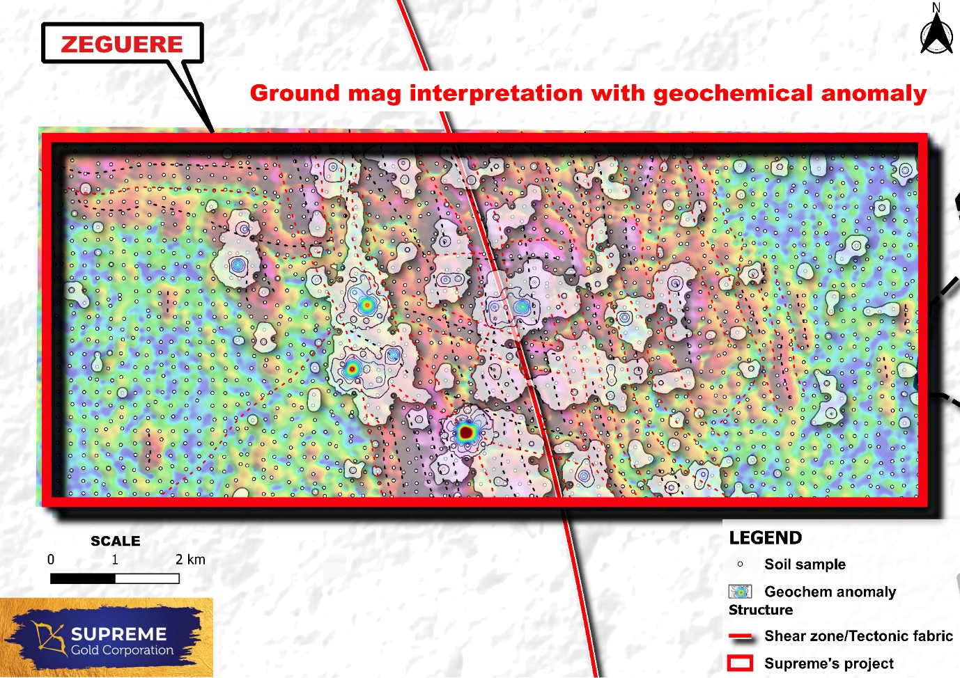
The results of interpretation of magnetic data, including inversion modelling along with the soil anomalies, stream sediment anomalies and multi spectral satellite image interpretation results have been integrated to identify and prioritize drill targets.